

I’m trying to use some Openstreetmap data in ODS.
However some of the data is formed where there are multiple lat/lon for an ID and when bringing it into ODS, ODS takes none of the lat/lon pairs when there are multiple. See screenshot of the multiple lat/lon pairs
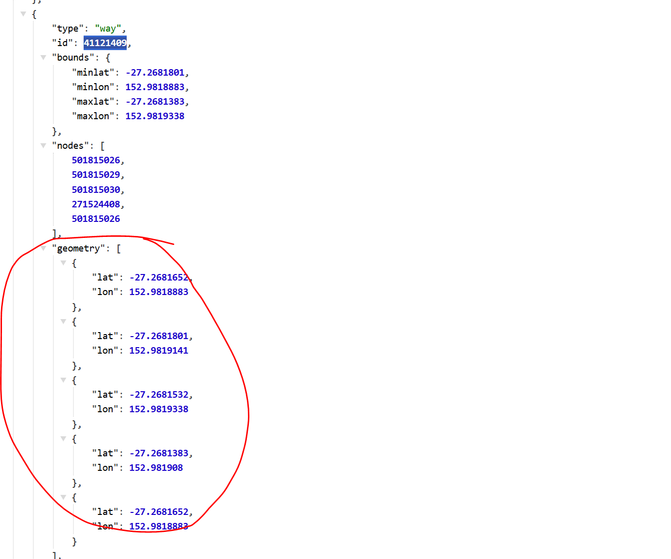
The records with multiple happen to be at the bottom as I think (assume) ODS uses the first 20 rows to determine a pattern. I want ODS to at least take the first pair of lat/lon so the data is somewhat accurate (at the moment it just ignores this and leaves the lat and lon fields blank.
Query used for bringing in the data is here: